


Corner Precinct, Custer County, Nebraska
About
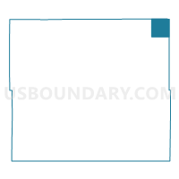
Outline

Summary
| Unique Area Identifier | 612647 |
| Name | Corner Precinct |
| County | Custer County |
| State | Nebraska |
| Area (square miles) | 35.64 |
| Land Area (square miles) | 35.64 |
| Water Area (square miles) | 0.00 |
| % of Land Area | 100.00 |
| % of Water Area | 0.00 |
| Latitude of the Internal Point | 41.69790460 |
| Longtitude of the Internal Point | -99.26959570 |
Maps


Graphs
Select a template below for downloading or customizing gragh for Corner Precinct, Custer County, Nebraska


Neighbors
Neighoring Voting District (by Name) Neighboring Voting District on the Map
- Comstock Precinct, Custer County, NE
- Precinct 1, Valley County, NE
- Rural 1 Precinct, Garfield County, NE
- Rural Sargent Precinct, Custer County, NE
- Sawyer Precinct, Loup County, NE
Top 10 Neighboring County Subdivision (by Population) Neighboring County Subdivision on the Map
- Sargent township, Custer County, NE (671)
- Rockford precinct, Garfield County, NE (299)
- Kent precinct, Loup County, NE (234)
- Comstock township, Custer County, NE (155)
- Geranium township, Valley County, NE (77)
- Eureka township, Valley County, NE (61)
- Corner township, Custer County, NE (21)
Top 10 Neighboring Unified School District (by Population) Neighboring Unified School District on the Map
- Ord Public Schools, NE (3,531)
- Burwell Public Schools, NE (2,036)
- Sargent Public Schools, NE (998)
- Loup County Public Schools, NE (639)
Top 10 Neighboring State Legislative District Upper Chamber (by Population) Neighboring State Legislative District Upper Chamber on the Map
Top 10 Neighboring 111th Congressional District (by Population) Neighboring 111th Congressional District on the Map
Top 10 Neighboring Census Tract (by Population) Neighboring Census Tract on the Map
- Census Tract 9717, Custer County, NE (2,721)
- Census Tract 9732, Garfield County, NE (2,049)
- Census Tract 9713, Valley County, NE (1,895)
- Census Tract 9728, Loup County, NE (632)